The Living Bay

For a Visit Dublin tourism campaign, Fáilte Ireland, the Irish tourism board, wanted to show that there was more to Dublin than Temple Bar’s pubs. The Living Bay campaign highlighted the coastal towns and natural landscapes right on the edge of Dublin, and was part of a broader initiative celebrating the city’s unique geography of city, sea and mountains.
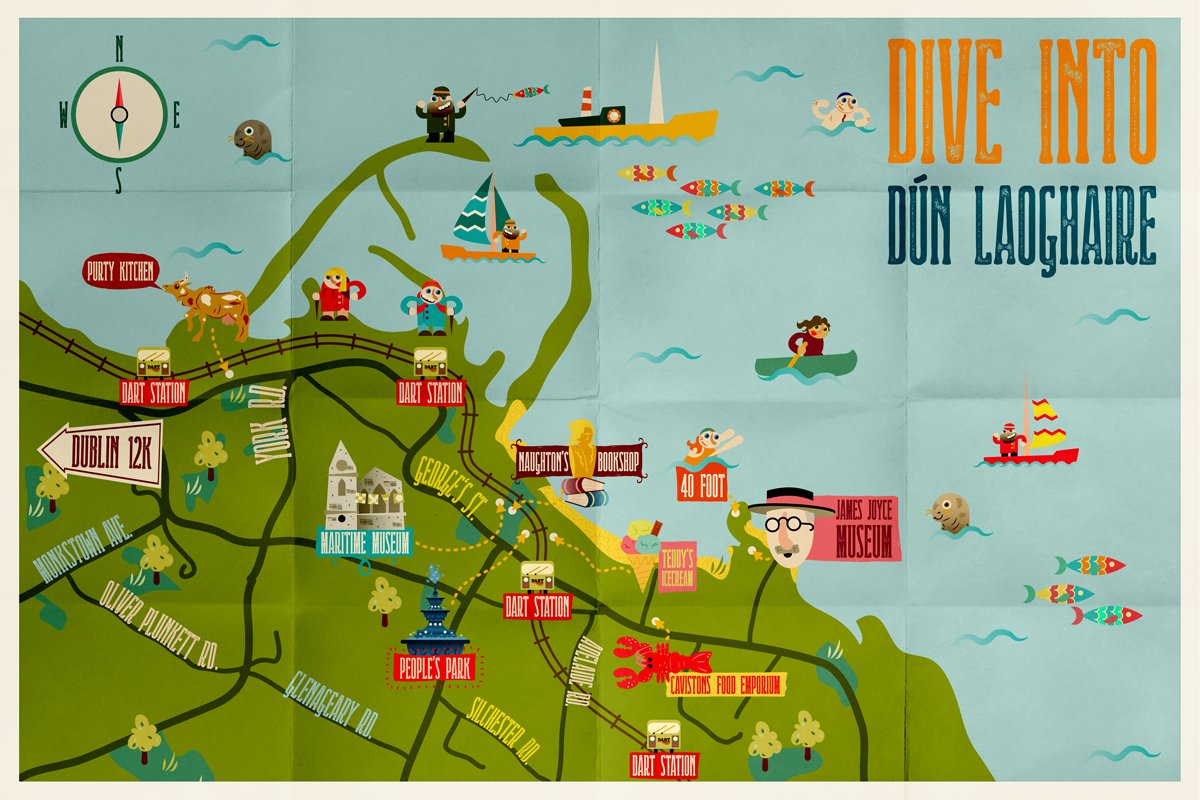
A series of illustrated maps were developed for each location mirroring the personality of the place. Each showcased a variety of points of interest and activities. The maps were designed to balance practicality and personality; though it was important that the maps were functional with key destinations and streets being clearly visible, playfulness played a part too. Each location had unique identities and featured characters interacting with their surroundings. The four maps were:
Malahide, with its medieval castle, quaint streets, cafes and small boutiques.

Howth, a living, breathing fishing village.

Dun Laoghaire, which boasts a range of water-based activities, and two walkable piers.
Dalkey, a heritage village with great walks, a beautiful harbour and spectacular views.
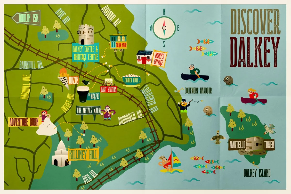
The maps gave an overall view of things to do and places to visit in each location, while articles written to accompany them provided a more complete itinerary.
Over the course of the Living Bay campaign. visitors to Dublin’s coastal towns increased by 18%, and Malahide Castle became one of the country’s most visited paid-entry tourist locations, attracting over 100,000 visitors that year.